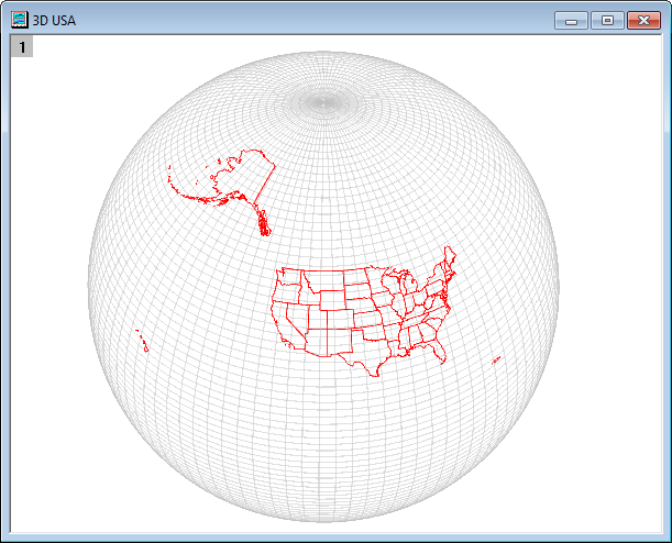
This app draws 2D objects from ESRI Shapefiles. Optionally, this data can be saved into a worksheet. These 2D objects include-
- points, which usually represent site locations;
- lines, which usually represent rivers, roads, and utilities;
- polygons, which usually represent geographic and political boundaries.
Points are generated as a regular scatter plot, while line shapes and polygons are rendered as graph objects. It's possible to select and modify the line and fill properties of each shape provided that the partial modification option is turned on while importing this data. We recommend turning off the partial modification option when there are too many features, as these may slow down the process depending on your machine's performance.
Installation
Download the file Import Shapefile.opx, and then drap-and-drop it onto the Origin workspace. An icon will appear in the Apps Gallery window.
NOTE: This tool requires Origin version 2017SR2 or later. If you have Origin2017Sr0 or Origin2017Sr1, please select Help: Check for Updates from Origin menu to first update Origin.
Operation
- Click the Import Shapefile icon and select a shapefile (*.shp) to open.
- Change display options as necessary. Click the Preview button or enable Auto Preview to check the result.
- Click OK button to create a map.
Dialog Control:
- Feature Names: The graph objects created from the shp will be named after the field values from the dbf according to the selected one.
- Display Option:
- Link Axis Length to Scale(isometric): Specify the Link Axis Length to Scale with X:Y Ratio=1 for shapefile layer. The option is selected by default.
- Rescale Source by Shapefile:
- If import the sharp file to the active graph window and check this option, the graph axis will be rescaled according to the shapefile. If uncheck it, the active graph axis scale will not be changed.
- If import the sharp file to a new graph window, this option will not affect the axis scale of the new graph.
- Allow Partial Modification: Specify the shapefile polygons import as multiple object or single object. After importing, you can check the result In the Object Manager window. There are three options:
- Auto: Origin will check the number of the shapefile polygons. If shapefile polygons > @shpdl (@shpdl is a System Variable, by default to 30K), it will be imported as a single object.
- Yes: Import the shapefile polygons as as a single object.
- No: Import the shapefile polygons as multiple objects.
- Output Data Points: Output the graph data points to workbook.
- ROI on Matrix: features will be added to the matrix as graph objects.
Shapefile Resources
- DIVA-GIS. Global data as well as Shapefiles covering many countries.
- OpenStreetMap. A wiki-based resource for geospatial data.
- US Census Bureau Data.
- The National Map Small-Scale Collection. USGS geospatial data for specific regions in the United States.
- Nation Weather Service - AWIPS Shapefile Database. Shapefiles from NOAA's Advanced Weather Interactive Processing System.
Examples:
- Shapes in a 2D graph

- Shapes in a 3D graph
