Images can be imported to either the Image window or the Matrix window, with some differences in image format support. There is some overlap in processing and analysis capabilities but, in general, the Image window excels at image cropping or video editing tasks while the Matrix window is needed for transformation and analysis operations (see linked list, bottom of page). Either will produce common plot types such as contour, 3D surface or image plots.
Note that you can convert an Image window image to matrix and so it should work to import images to the Image window, do you image cropping there and convert to matrix to complete other operations on the image.
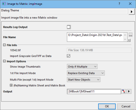
To import an image or image stack to the matrix window:
The matrix has two View modes. In addition, the matrixsheet can contain more than 65k matrix objects and so there are controls for scrolling and selecting matrix objects.
For more information, see Image Conversion.
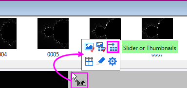
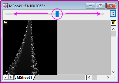
To show the selector region and toggle between thumbnails or slider control, use the Mini Toolbar that shows when you hover on an active matrix window.
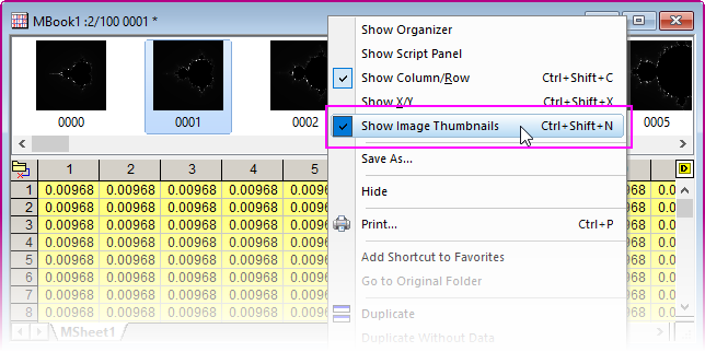
To display thumbnails:
To replace the thumbnail image view with the slider:
Note that you can disable display of both thumbnails and slider by clicking the Image Selector button located just to the left of the Slider or Thumbnails button on the Mini Toolbar.
See documentation of the wbk.selector and wbk.slider object properties.
When importing multi-frame TIF files, thumbnail/slider display is controlled by system variable @MSS (default value =10):
|
When viewing matrixsheets or matrix objects in Image Mode (View: Image Mode), you can extract information using the Region-of-Interest (ROI) tools.
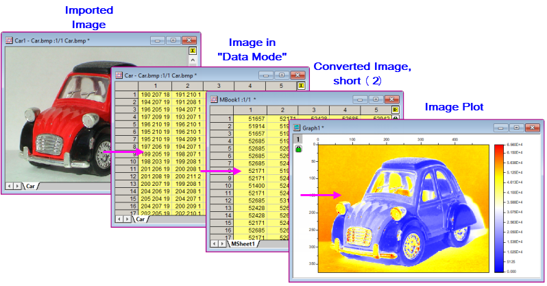
Once converted to data, images in a matrix can be plotted as an Image Plot. This displays the data as a 2D plot where each matrix cell corresponds to a "pixel" in the graph.
GeoTIFF is a public-domain image format that stores spatial information in a TIFF file and which has applications in mapping. Starting with Origin 2022b, Origin supports import of GeoTIFF files to both matrices and Image windows.
For information on importing and analyzing GeoTIFF images, see GeoTIFF Importing and Processing.
NetCDF is a self-describing, scalable format file for storing arrays of variables. Designed as a flexible format for exchange of scientific data, it is readily adaptable to geographic studies and is widely used in atmospheric and climate science. For information on importing and analyzing NetCDF in Origin, see NetCDF Importing and Processing.
The following sections provide information on working with images in matrix window.